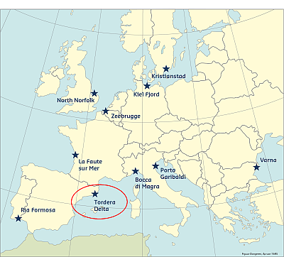
The Case Study site of the Tordera Delta area is located at the Tordera river’s mouth (Punta de la Tordera), covering an area of approximately 1.4km2. It is a low-lying, coastal plain and as so, a large part of the delta plain, mainly south of the mouth, has a low relative height, with respect to the Mean Sea Level (1–1.5m). This configuration is creating increased vulnerability to flooding of coastal and river origin, during storm events.
The Tordera Delta Case Study site is a profound example of an area where the adequate protective mechanisms of the local ecosystem were significantly weakened due to poorly designed human interventions, thus resulting in increased vulnerability and risk from extreme events. Erosion and inundation are the main hazards that this area faces are due to storm impacts.
Coast and hazards
The delta affects two contiguous municipalities, separated by the river, a natural border between them: Malgrat de Mar, southward of the river, and Blanes, northward of the river. The total population of the area has increased from 10,942 in the 1940’s to 58,089 in 2013. According to municipal data, there is approximately 18% increase of the population during the summer due to the tourism importance of the region.
Due to its location in the Catalan coast (north-central), the Tordera delta coastline is directly exposed to the action of most energetic storm waves in the area (E-NE storms) as well as to those coming from secondary directions (S). The damage magnitude has increased during the last decades along the Catalan coast. However, as Jiménez et al. (2012) have pointed out, this is not the result of any increase in storminess but the combination of increasing values at exposure along the coast due to the urban development and, the dominant erosive behaviour of the sandy Catalan coastline which has decreased the protection function provided by beaches. This is particularly evident in the study area since the coastline is significantly eroding during the last decades (since the late 70’s), although it was an originally accretive/stable area (Jiménez et al. 2011). Coastline erosion subsequently increases the magnitude of coastal floods and the direct exposure to wave action. Storm-induced damage varies from minor problems due to beach and promenade overtopping to severe problems affecting promenade stability and severe problems affecting infrastructures of a desalinisation plant and camp sites. The main values at stake are a coast supporting present activities and use (recreation, tourism), maintaining its natural values (mainly related to the landscape and the proper existence of long and relatively wide beaches) and providing protection to existing values in the hinterland.
Predictability
Since this is a low-lying area (coastal plain), a large part of the delta surface (mainly south of the mouth of the river) has a low relative height with respect to the Mean Sealevel (1–1.5 m), with some zones in the hinterland lying below +1 m. This topographic configuration makes the study case zone vulnerable to flooding from both river and sea during storm events of coastal and river origins. Thus, with respect to river flooding, the entire area has been recently catalogued as a high risk area even for relatively frequent events. This has been done within the framework of works done by the Catalonian Water Agency (ACA) to implement the European Flood Directive.
The case is a highly dynamic area. It has to be considered that the real extension of the inundation will be strongly controlled by the coastal configuration at the time of the storm impact since it behaves as the only element providing natural protection to the hinterland. Any attempt to increase the predictability of river floods and the coastal configuration at the time of the storm and/or to reduce the uncertainty in the expected magnitude, must include the coastal morphodynamic response during the event. Moreover, due to the observed variability in the coastal configuration it should be also necessary to frequently update beach topographic data.
Historical flood events
The area is subjected to flooding from the Tordera river. According to the existing river flow records (ACA, 2002; 2011) there have been (at least) 38 river floods during the last 7 decades. Additionally there is also some information about historic floods (before the “measurement” period), with the most important ones taking place in years 1732, 1777, 1787, 1840, 1898, 1902, 1907, 1919 and 1930 (ACA, 2002; 2011).
They are usually analysed in two separated periods: before and after 1960. Before this year, the river can be considered as a natural system presenting a high mobility during floods with frequent inundations and course switching in the alluvial flood plain. After the 60’s, the river course losses mobility mainly due to human action (extraction of several million of m3 of sediment from the river course). In this situation, there is a lack of connection with the flood plain in the lower river course (ACA, 2002). As it can be seen, in most of the cases, inundation mainly occurred during pre-60 events, when the river was not significantly modified by human action.
As a result of the progressive narrowing of the beach in the area, the frequency of inundation episodes and damages to existing infrastructures (beach promenade, camp sites’ installations, desalination plant infrastructures) has significantly increased since the beginning of the 90’s (Jiménez et al. 1998; 2002; 2011; Sardá et al. 2013).
This information was has been reproduced from the Risc-Kit "Review report of key challenges and lessons learned from historical extreme hydro-meteorological events". The full report can be downloaded here.
This information has been extracted from the RISC-KIT "Review report of key challenges and lessons learned from historical extreme hydro-meteorological events".
The datasets on storms are available for download from the project’s historical storm database.
REFERENCES
LINKS
RISC-KIT HISTORICAL STORM DATABASE: HTTP://RISCKIT.CLOUDAPP.NET/RISCKIT/#/MAP
RISC-KIT "REVIEW REPORT OF KEY CHALLENGES AND LESSONS LEARNED FROM HISTORICAL EXTREME HYDRO-METEOROLOGICAL EVENTS": WWW.RISCKIT.EU/NP4/FILE/23/RISC_KIT_DELIVERABLE_D.1.1_V3.PDF