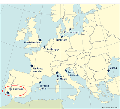
The Ria Formosa coastal lagoon case study site is a wildlife resevoir (protected area) that is located on the southern coast of Portugal. It consists of a lagoon protected by five barrier islands and two peninsulas, separated by six tidal inlets and spatially distributed to produce a cuspate shoreline that extends over 55km. The islands' width varies between tens of meters to more than 1.3 km with dunes sometimes reaching 9 meters height. The area is a wildlife reservoir (protected area) with magnificent sand dunes. The barrier islands are highly dynamic systems in a constant process of recycling, mostly driven by inlet breaching and migration. At present, two out of the six tidal inlets are artificially constructed, three have been relocated and only one preserves its natural behaviour. The back-barrier area consists mainly of tidal flats, salt marshes, small sandy islands, and tidal channels.
The combined factors of a low lying barrier island system with high ecological value and the existence of multiple anthropogenic activities, classify Ria Formosa as a very complex system with potential for the occurrence of significant impacts due to climate change and low-frequency, extreme storm events.
Within the Ria Formosa system - which covers almost 60km - the RISC-KIT project focuses on the hotspot of Praia de Faro, a settlement at the western part of the system about 5 km long, implemented over the dunes of the Ancão Peninsula.
Coast and hazards
Storms impact the area every year as wave heights above the storm threshold (3 m) are relatively frequent. Those storms constitute the major source of threat to the area as they may provoke substantial beach erosion and overwash. Beach erosion will in this case depend on the magnitude of the storm impacting the beach and on the state of the beach (i.e. in terms of sediment budget). In this regard, storm groups impacting the beach will likely have more severe consequences on beach erosion. Major local goals are ensuring public safety mainly against storms and erosion and preserving natural values.
Predictability
Wave climate forecast is provided by the National Institute for the Ocean and Atmosphere (IPMA). For that, the IPMA applies a large scale wave climate model to continental Portugal.
The wave climate parameters are provided by Wave Model (WAM), which has a spatial resolution of 0.25º, and by the European Shelf Model (LAM), which has the resolution of 10º of the European Centre for Medium-range Weather Forecasts (ECMWF) and correspond to the closest grid point prevision for a given beach. The latter provides the prevision of the wave climate and wind field regime from the ECMWF atmospheric model. Previsions are given for a maximum of 5 days ahead and are updated every day.
Historical flood events
The big storm of 1941 had a remarkable impact on the barrier islands system. Due to very low number of people living there, and to the very low development of infrastructure in the island the references to the storm at small scale are related to the effects on the small fishing communities in the barrier island. Conversely, there is plenty of information regarding the effect of this storm at regional level, as it was felt over the entire country and of course at Algarve. Several shacks, boats and port installations were destroyed in the region especially affecting fishermen. The storm had an important effect on the Algarve regional economy with around 30 000 contos (30 million escudos) of damage costs, which translates to a modern day value of 150 million EUR in 2009 (Muir-Wood, 2011). At Ancão Peninsula a new inlet was opened (source). The same storm destroyed the tuna fishing infrastructure of Medo das Cascas close to Tavira and one of the most important in the Algarve.
Within the eastern part of the system, the opening of an inlet almost 1000 meters wide (Cochicho Inlet, former Cabanas Inlet) provoked the destruction of Cabanas Island in 1941. This significant change in the island morphology triggered the subsequent sedimentation and closure of Tavira artificial inlet (opened in 1927) and the disappearance of the internal channel that ran parallel to the island, which had impacts on the socio-economic tissue. Despite such large geomorphological changes on the islands and the disappearance of three fishing camps, there were no casualties, only material damage.
Other important storms impacting the study area occurred in the sixties (1961), with important consequences over the tuna fishing facilities (armação) owned by the fishermen communities in the barrier islands; the armação located in Cabanas Island was destroyed at the beginning of the sixties due to the shift of the inlet and the breaching of the barrier island.
During the end of the seventies there were also severe storms that affected the populations of Faro, Olhão, Fuzeta and Tavira. In Praia de Faro, during February/March 1978, the populated area was overwashed with minor damages while the following winter the storms caused the destruction of some houses.
During autumn 1989 and winter 1989/1990, new storms hit the barrier islands with important consequences not only for the natural sand barriers but also for the artificial infrastructures and houses. Praia de Faro suffered intense overwash and shoreline retreat together with the partial destruction of seawalls and houses whose major consequence was the construction of protection structures in the beach (emergency rock construction). Besides this, the storms forced the authorities of local civil protection to close the bridge for several days. Therefore, the only access to Praia de Faro was in an army barge (Ferreira, O. 2014, personal communication). During the winter 1989/1990 a seawall was built and afterwards partially destroyed (230 m of the seawall collapsed). The damaged areas (road, walls and buildings), were rebuilt exactly at the same spots.
During the winters of 1996 and 2002 the entire wall from Havana to Zé Maria restaurants was damaged and destroyed. Overwash reached the lagoon. The road and the walls were rebuilt at the same location (source: own surveys).
A new series of storm events occurred in winter 1998 provoking the destruction of few houses (Teixeira, 2009). The last series of storms with major impact on the barrier islands of the Ria Formosa occurred during the winter 2009/2010. During this winter, overwash was enhanced and erosion provoked also the partial destruction of few houses of fisherman in Praia de Faro while in Culatra Island the waves overwashed the Culatra Island at Farol Beach surpassing the seawall and destroying one Bar (marAmais)1. During the same winter, the highly destructive storms partially or totally destroyed 44 of the 71 private buildings in Fuzeta (Ilha de Armona) and opened a new inlet (Source: publico.pt and own surveys).
This information has been extracted from the RISC-KIT "Review report of key challenges and lessons learned from historical extreme hydro-meteorological events".
The datasets on storms are available for download from the project’s historical storm database.
FOOTNOTES
1 The name means both 'sea to love' and ironically, 'too much sea'.
REFERENCES
Freitas, J.G., Dias, J.A., 2013, 1941 windstorm effects on the Portuguese Coast. What lessons for the future ? Journal of Coastal Research, SI65 : 714-719.
Muir-Wood, R. 2011. The 1941 February 15th Windstorm in the Iberian Peninsula. Trébol, 56, 4-13
LINKS
RISC-KIT HISTORICAL STORM DATABASE: HTTP://RISCKIT.CLOUDAPP.NET/RISCKIT/#/MAP
RISC-KIT "REVIEW REPORT OF KEY CHALLENGES AND LESSONS LEARNED FROM HISTORICAL EXTREME HYDRO-METEOROLOGICAL EVENTS": WWW.RISCKIT.EU/NP4/FILE/23/RISC_KIT_DELIVERABLE_D.1.1_V3.PDF
Publico news portal: www.publico.pt