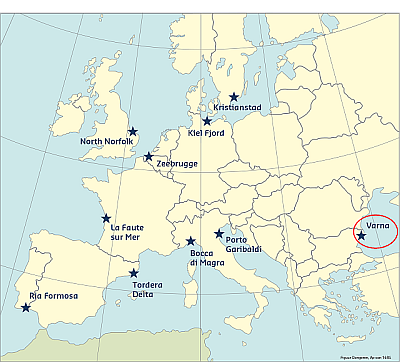
The Varna case study area is located on the western Black Sea coast. The area runs from cape St. George in the north, to cape Galata in the south, while at regional level it stretches from cape Ekrene to cape Cherni nos. The most western part of the bay is a sandy spit – a low-lying area with range of width varying between 2,000 and 2,700m. Two navigable canals running through the sandy spit connect Varna bay to Varna Lake, as the latter is linked also to Lake Beloslav to the west. The length of both lakes and the canals is about 30km.
The case study site represents a unique combination of low-laying beaches and an artificial island, occupied primarily with touristic and industrial activities, and residential, touristic and park areas located on a cliff prone to land sliding. The largest transport and port agglomeration in Bulgaria –the Varna-Beloslav-Devnya industrial complex, is located here and covers an area of 150km².
Coast and hazards
The coastal area of Varna is erosive, with more than 50% of the coast directly affected by wave induced erosion. Wave exposure of the coastal stretches within the site varies from exposed in the northern part, to extremely exposed in the south, while the wave exposure of the bay itself varies from sheltered to exposed. The site is situated on a sand spit, in a low-lying (liman) area. Lacking large rivers, flood risks originate predominantly from extreme weather events that are marine in origin. The most hazardous event in this regard is a combination of storm surge and wave attack on the coast leading to beach erosion and putting the adjacent critical infrastructure and public/private property at risk. Most relevant threats are storm impact (storm surge, wave action, and beach erosion), landslides, flash floods, coastal water quality, and effectiveness of sewage system
The wind wave patterns from the east and the northeast have critical impacts on the area but important events can be expected from the southeast as well. The eastern waves are predominant within the entire shelf zone, ranging between a 30 and 40% probability of occurrence. The most frequent significant wave height is smaller than 1.5 metres. On rare occasions, it is larger than 4 metres, while waves around 7 metres have a return period of 100 years. The storm surge level with corresponding return period is about 85 cm. Tidal fluctuations are very small and considered irrelevant. Largest waves are observed during the storm season (October-March), which can reach a 7 metres significant wave height. The current trend for sea-level rise (excluding subsidence) is estimated to be 1.2 mm per year. Coastal risks predominantly originate from extreme weather events, such as strong winds and heavy rains.
Predictability
Atmospheric circulation above the Black Sea is quite complex, as it involves the interaction of cyclones originating from the Northern Atlantic and the Mediterranean, and anticyclones coming from North-eastern Europe. The most typical atmospheric pattern is characterized by the presence of a anticyclonic area over the northern part of the Black Sea and cyclonic conditions over its southern part. On the other hand, the basin is of complex form and orography that further hampers the forecasting ability of models. Therefore, high resolution wind forcing is needed to assure a good predictability of storm waves and surges in the Black Sea. Presently, 72-hour wave forecasting for the Bulgarian shelf and coastal waters, performed by the National Institute of Meteorology and Hydrology, is based on wind forcing of 0.125° spatial resolution. The main Numerical Weather Prediction model in use is ALADIN.
Historical flood events
One hazardous event of note is a downpour that took place on 20th August 1951 lasting for 9 and a half hours. For 24 hours, Varna meteorological station measured a total precipitation amount of 257.8 l m-2, where the monthly average for August in Varna is 36 l m-2. The reported damages affected city street pavements and flooding since the city drainage system was not able to deal with such large amounts of water.
Other storm events that caused significant damages along the entire Bulgarian coast occurred during the late 1970s. As of today, they are the most researched and cited storm events that have taken place along the Bulgarian coast (Andreeva et al., 2011). The first one took place on 15-21 October 1976. Maximum wind speeds reached 28-29 m/sec, sea conditions were severe with wave height between 2.5-3.5 m, and mean sea level rise at the Varna level gauge reached 0.8-1.0 m. The reported damages occurred at the front and rear face of the main breakwater at port Varna. Based on the IO-BAS archive data, the thickness of the eroded layers at the beaches of “St. St. Constantine and Elena” resort and Varna was 0.68 m and 0.63 m, respectively. The second storm occurred on 16-21 January 1977. The reported maximum wind speed was 24-29 m/sec, and sea conditions again were rough, with waves 2.5-3.5 m in height. Since this second severe storm took place only few months after the previous one, the damages on the port Varna breakwater became even more pronounced. Large concrete pieces were dislodged from the front face of the pier; while at the back, deep pits were formed. The road behind the pier, near “Varna port” yacht club also suffered substantial damages. Large waves spilling over the pier wall cut off the lighthouse electricity.
From the 1980s to 2010, there were a number of heavy storms, though information about the damages they caused could not be found. In 2010, the Bulgarian coast experienced a heavy storm that started on 7 March and continued for about 120 hours. Storm parameters were extracted from a hind-casting database covering the period of 1948-2012, for a grid point located in front of Varna bay at a depth of 18 m. The maximum significant wave height reached 6.21 m, with waves approaching from the east and wind from N-NE with maximum speed of 20.2 m /s. The Varna tide gauge registered sea level rise of 0.6 m. At Varna Central beach (north), almost all sand was washed away. The seaside alley (i.e. “Fist alley”) was overtopped and covered with sand and stones of different sizes, which came from its revetment. Additionally, the road was surface was damaged in several places.
The storm of February 2012 was one the most severe recent storms in Varna. The waves on this day were up to 7 meters high. They washed the sand from the beaches and led to landslides and abrasion. Due to low air temperature (below -10 degrees), the breakwater of port Varna was covered with ice, but nevertheless it suffered significant damage from breaking waves, like dislodged pieces of the breakwater body and revetment, as well as undermined foundations. The breakwater was constantly overtopped during the storm, which led to flooding of the road and port area behind it (xx) However, the icing of the breakwater played a positive role, especially on the north coast because it "cemented" the coastal protection structures such as tetrapods, rocks, walls and coastal roads and prevented them from major damages. In comparison, in February 1979 under similar weather conditions, the sea level rose by only 90 centimeters and the strong waves smashed parts of the breakwater and flooded the low lying coastal marine park. (Ivan Ivanov, 2012).
This information has been extracted from the RISC-KIT "Review report of key challenges and lessons learned from historical extreme hydro-meteorological events".
The datasets on storms are available for download from the project’s historical storm database.