The harbour of Zeebrugge consists of 3 parts: (i) the outer port, (ii) the inner port and (iii) the seaport of Bruges. The outer port has been constructed on land reclaimed the sea and is protected by two breakwaters. The direct access to the sea and the available water depth makes this part of the port appropriate for roll-on/roll-off and container traffic. Also Liquefied Natural Gas (LNG) vessels moor in the outer port. Around the docks of the inner port logistic centres are located for the handling, storage and distribution of mobile vehicles, break-bulk cargoes or food products. The connection with the seaport of Bruges is made through the Baudouin canal. The activities in this part of the port mainly consist of bulk and conventional cargoes. The residential area of Zeebrugge is located in between the harbour locks.
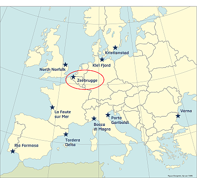
The case study of Zeebrugge, with its industrial port, is important for RISC-KIT because it will focus on diverse aspects of coastal risk management, including economical aspects of an industrial port. The outer port of Zeebrugge is a weak link regarding the area’s coastal protection, as it is not integrated in the masterplan for coastal safety, which has been focussing on protecting people. The protection level of the outer harbour is not known as no flood risk studies of the outer harbour have been performed before.
Coast and hazards
The coastal environment in the general area of the case study site is macro-tidal with sandy beaches. The coastal zone comprises three main units: (i) a very gently sloping and fine sandy beach, (ii) a dune ridge and (iii) a coastal plain. The area presents a bidiurnal tide with a small asymmetry and an average tidal range of 4m. The tidal wave moves along the coast from west to east. The tidal range decreases in the same direction by +/-0.5m. Spring tides occur twice a month when the tidal variation has reached its maximum (+/-5m), while for neap tides the tidal range reaches its minimum, i.e. +/-3m. Long-lasting intense winds may influence the water level, resulting in extremely low or high water levels. This important tidal range is linked to quite significant tidal currents, which exceeds generally 1.5knots in the near shore areas. Because of the shallow seas and the short fetch, waves are typically short crested. The wave climate is mainly determined by meteorological circumstances, predominantly southwesterly winds, and by the shallow depth of the North Sea. Under normal circumstances the waves are lower than 1m. During heavy storms wave heights of over 5m can occur. The wave period is 3 to 4 seconds under calm weather conditions, but during storms it can reach 10 to 15 seconds.
Zeebrugge is a vulnerable area to flooding during extreme events. The weak point of Zeebrugge, as mentioned in the Masterplan for coastal safety, is the port of Zeebrugge. A planned storm wall is mainly concentrated around residential areas, indicating that these measures are mainly intended to protect the inhabitants, rather than the harbour activities and companies themselves.
Predictability
Nowadays, the capabilities for forecasting big storms are much more advanced than in the past. The Oceanographical Meteorological Station (OMS) at Ostend keeps an eye on the weather and tidal levels at the coast and in the harbours seven days a week. The meteorologists of the OMS have real-time measurements of the Monitoring netwerk Flemish Banks (Meetnet Vlaamse Banken) at their disposal. This consists of measurements piles and wave buoys which measure waves, tide, water temperature, wind, air pressure, air temperature and precipitation. Furthermore, the meteorologists also use results of specific numerical forecasting models for waves and tides, and all possible metorological information, such as satellite images and meteorological surveys. All this information is processed into specialised weather reports with forecasts of tides, waves, wind and visability. Those coastal weather forecasts are available for the public on the website www.kustweerbericht.be. These weather forecasts are also used by the Coastal Division to send out warnings in case of abnormal high waterlevels at the coastal areas.
Thanks to the OMS and the KMI (Royal Meteorological Institute) the storm of 6 December 2013 was well predicted. Therefore, the coastal cities could prepare themselves. The severe storm of 1 February 1953 was a surprise for the former meteorologists, but with the current technology of the KMI and OMS such a storm is nowadays better and faster predictable (Dehenauw, 2003).
Historical flood events
The historical storms mentioned below are based on storms registered by the KMI (2014) for storms before 2000 and registered by Kustweerbericht (2014) for storms after 2000. Determining if a historical storm is worth mentioning depends upon the caused damage, the general impact and the heights reached by water levels in Ostend and Antwerp. Moreover, only storms with a known socio-cultural, political or physical impact and which occurred after 1953 are mentioned.
A previous study of IMDC in 2005 describes in detail the consequences of the storm of 1st February 1953 on the Belgian coast. Due to the combination of a lengthy storm and a south-western to north-western wind direction (Guilcher, 1953), a lot of water was transported to the Belgian coast, which, in combination with a spring tide at the same moment, caused inundations and breaches (Dehenauw, 2003). Wind gusts of 155 km/h in Ostend and 122 km/h in Antwerp were registered (KMI, 2014). The highest measured water level was 6.66 m TAW in Ostend and 7.77 m TAW in Antwerp (Dehenauw, 2003). This corresponds with “dangerous storm tide coast” and, respectively, “dangerous storm tide Sea Scheldt”. In total, 4.6 km of the 66 km long coast was severely damaged, including 3.8 km of frontal dikes especially due to the wash out of the sand. In Ostend, 50% of the damage could be related to the overtopping of the dike and 50% to the water streaming via the harbour in the inner city. The total number of victims in Belgium due to the inundations at the coast and along the Scheldt varies between 14 (Gva, 2003) and 22 (Jonkman et al, 2003). Of these, eight almost certainly drowned at the Belgian coast. The measures taken after the storm tide consisted of continuing with the infrastructure works which were already started before the 1st of February, as well as developing new coastal protection measures.
A combination of north-western wind and spring tide caused high water levels at the coast on 14th November 1993. At Ostend, an extreme water level of 5.98 m TAW was registered. Offshore waves likely reached a significant wave height of 8 m to 9 m. Dune erosion and erosion of the yearly raised beach banks was noted along the entire coastline. In particular, the dunes between Bredene and Zeebrugge were damaged with major cliff erosion up to 8 m. Moreover, in several places, (defence) structures, such as dikes and breakwaters, were damaged. No casualties were recorded, nor did flooding occur.
During the storm between 31st December 1994 and 3rd January 1995, an extreme water level of 5.90 m TAW (AWZ, 1995) was observed in Ostend. Offshore, significant wave heights of 2.5 m at the Akkaertbank and 4.0 m at Westhinder were measured (AWZ, 1995). Exceptional for this storm is the combination of relatively high water levels during high tide and the long wave energy. In general, no intense erosion was observed. The observed erosion at the foot of the dunes complied with the erosion begun in 1990, which caused the decline of the coastline. At a few places, the dunes were likely to collapse. The most damaged dunes were found between Bredene and Zeebrugge with exception of the part between De Haan Vosseslag and De Haan Zwarte Kiezel. In this last part soft defence works were executed. Also the beach nourishments protected the dunes.
This storm of 19th February 1996 is characterised by an extreme water level of 5.33 m TAW at Ostend, a significant wave height of 3.5 m at the Akkaertbank (offshore) and western till north-eastern wind direction (AWZ, 1996a). This storm caused less damage along the coast compared to the storms of 1993 and 1994 (AWZ, 1996a). The storm hit badly mainly along the west coast. A lot of erosion was observed at the foot of the dunes in De Panne, Koksijde and Nieuwpoort. The yearly built dry beach banks were severely damaged at Middelkerke and in the western part of Ostend.
This summer-storm of 29th August 1996 can be compared with a winter-storm with a rather high intensity. The storm report of AWZ (1996b) is based on a visual inspection on 2 September 1996. Because this storm took place during the summer tourism season, most damage occurred to objects on the dyke that couldn’t be brought to safety. On 2 September 1996, the damage was more or less cleaned up. Because of a high rate of Eolithic transport, the beach and dyke needed to be cleaned up.
During this storm between 8th and 10thNovember 2007 waves with a height of 4 m to 6 m were registered offshore on 9 November 2007 (Kustweerbericht, 2014). The storm caused some damage to coastal infrastructures. The foundations of the administrative centre of the Shipping Assistance Division in Ostend were exposed due to the high waves and a part of the parking at the quay disappeared into the sea (Nieuwsblad, 2007). In Nieuwpoort, slight damage was noted at the wooden eastern and western pier. Also the armour layer of the harbour’s seawall was damaged. Erosion cliffs occurred in Wenduine, Bredene and Ostend. The floor covering of the promenade in Wenduine was also damaged. No casualties were recorded, nor did flooding occur.
The combination of spring tide with a storm on 6th December 2013 at the North Sea caused an increase of the sea level of about 6.30 m TAW at the coast (Meetnet Vlaamse Banken, 2013) and waves between 2.00 m and 4.00 m high. It was predicted to be the highest water level along the coast since 1953, which proved to be correct. Thanks to the fact that a lot of measures were taken between 1953 and the present, the impact of the storm was very small (compared to the storm of 1 February 1953). Moreover, this storm was predicted which made it possible to take preventative measures. In Antwerp, the Scheldt quays inundated, but thanks to the closing of the openings in the storm wall surrounding the quays, only the quays were flooded and the inner city was spared. At the coast big dune and beach erosion occurred, but no damage due to inundations was noted. The dunes and beaches had to be repaired to have the same protection level as before the storm. During the storm a lot of sand has been blown away or washed out by the high water level. This caused some beach cliffs and damaged the dunes, but it proves that the dunes and the beaches protect the inner land.
This information has been extracted from the RISC-KIT "Review report of key challenges and lessons learned from historical extreme hydro-meteorological events".
The datasets on storms are available for download from the project’s historical storm database.
REFERENCES
LINKS
RISC-KIT HISTORICAL STORM DATABASE: HTTP://RISCKIT.CLOUDAPP.NET/RISCKIT/#/MAP
RISC-KIT "REVIEW REPORT OF KEY CHALLENGES AND LESSONS LEARNED FROM HISTORICAL EXTREME HYDRO-METEOROLOGICAL EVENTS": WWW.RISCKIT.EU/NP4/FILE/23/RISC_KIT_DELIVERABLE_D.1.1_V3.PDF