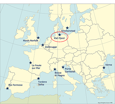
The Kieler Fjord site is a fjord at the Western Baltic Sea, about 20km long and at the mouth up to 7km wide. Kiel is located on the Baltic Sea (Kieler Fjord) in the federal state of Schleswig-Holstein. It is the terminal of the Kiel Canal, the busiest artificial waterway in the world. Even though storm surges are less frequent on the Baltic Sea, storms “can be a dangerous surprise during proper wind from the right direction” (MELUR, 2008: 9, trans. by CSO).
A generally well--‐organized rescue system and a protection system against risks from the seaside have been established in Germany. Coastal defense lies within the responsibility of authorities, but there are exceptions when it comes to areas that are located outside of the defended zones. Beaches and also the marinas are to some extent covered by the responsibility of authorities. These areas are outside of the direct responsibility of the coastal defense authorities because this is not of concern for the general public, but an aspect of ‘leisure’. Hence, individuals are responsible for the implementation of preparedness and prevention measures. The case study will therefore focus on marinas and beaches used for camping grounds.
Coast and hazards
The inner part of the Kiel Fjord is up to 2.5km wide. It is open to the Baltic Sea in north-northeast direction. The outer fjord is characterized by sandy beaches and on the western border by sandy cliffs. Small villages have developed along the coast in the outer fjord. The local population was traditionally occupied in small-scale fisheries but after industrialization the touristic business developed and displaced almost the whole traditional fishery. Today the villages are characterized by beach tourism and water sports activity including the business around it. The inner fjord is dominated by the City of Kiel, the capital of the German Federal State Schleswig-Holstein, with about 250,000 permanent residents. The center of the city is directly located at the waterfront and occupied with different ports and shipyards.
The Kiel Fjord region was affected by heavy marine surges several times and, even if there are high standards of coastal protection in Germany, it still has vulnerabilities due to the fact that high values are exposed to the water during summer season. Storm surges in the Western Baltic fulfil the criterion of floods with small probability but heavy impact to the prosperity of the region. In August 1989 a small pressure system caused a storm surge, which had heavy impact to marinas in Wendtorf and Kiel as well to beaches and their infrastructure, camping sites, and cliff coasts. In combination with storm flooding, increased swells in the Kiel Fjord also occur regularly, because north-easterly winds have sufficient fetch on open water. During north-northeasterly winds, the swell can even enter the inner fjord, though the swell is weakened.
Predictability
Among other factors, the predictability of these events depends on the potential of the forecast model to predict the causal weather event properly. The smaller the spatial scale of a storm front, the more difficult it is to exactly reproduce the development and the ongoing evaluation of the storm. In contrast, the accumulation of wind set-up, basin oscillations and tidal events can be calculated by modern oceanographic models about 48 hours in advance for the entrance of the Kiel Fjord. The quality of these calculations can be considered quite strong. For example, the storm surge in 1872 could be recalculated quite well by the Federal Maritime and Hydrographic Agency (Bundesamt für Seeschifffahrt und Hydrographie, BSH). Nowadays smaller-scale, high-resolution models are able to reproduce the local effects of wind and input signal.
Historical flood events
The storm surge of 1872-11-13 was a remarkable and singular event, and appears to have been extremely heavy (Baensch, 1875; Bork & Müller-Navarra, 2009; Wikipedia, 2013). This event was the highest recorded flood across the entire coast of the Western Baltic Sea and is evidenced in many coastal towns by high water marks. This surge deviates significantly from the other events listed, both in terms of the method of measurement and the absolute altitude. This extraordinary flood event had maximum water level heights of more than 3 meters above MSL, and affected the entirety of the southern Baltic Sea coast. Countless towns and villages were flooded. Approximately 250 people lost their lives, and the surge caused heavy property damage. For example, the Port of Stralsund was burned down. “The principal reason for the great destructive power was the extremely long residence time of high water levels higher than 1m above sea level with a total of more than 48 hours” (Markau, 2006, translated from German).
The second highest flood was the New Year Day's flood of 1904, which was recorded by modern gauges. This event was recorded as a very heavy storm surge in both locations, Kiel and Travemünde. The flood was remarkable enough that its hundredth anniversary was observed as an event by the city of Kiel in 2004 (Geckeler 2004).
Additionally, one of the more notable floods was the flood event of Kiel in 1989. The special feature of the storm surge was not the maximum height of the water level, but the fact that this event occurred during summer time, the only documented storm surge to have done so. The damage was so significant that the Wasser- and Schifffahrtsamt Lübeck (the Fairway Administration) conducted an investigation into this flood (Buhr, 1990; Wasser- und Schifffahrtsamt Lübeck, 1989; Neemann, 1994, 1989). An illustrated book documents the perspectives of yacht owners, who were affected by the event in the Marina Wendtorf (Kling, 1989).
Since the 1989 flood, at least three floods have exceeded its height, in 1995, 2006 and most recently in January 2017. Here, storm "Axel" produced the biggest flood event in ten years. The dike in Wallnau on the island of Fehmarn was heavily damaged over a stretch of 300m. The federal state began work immediately to secure the dike and prevent damage to the island over the remainder of the storm flood season.
This information has been extracted from the RISC-KIT "Review report of key challenges and lessons learned from historical extreme hydro-meteorological events".
The datasets on storms are available for download from the project’s historical storm database.