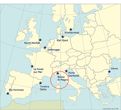
The Bocca di Magra Case Study site is located at the mouth of the Magra River in Italy, Liguria Region, Province of La Spezia, municipality of Ameglia and Sarzana. The territory of the Magra River Basin is classified as mainly mountain and hill area, with absence of lowland territories, even at the mouth of the river. The basin, in its more elevated and steep slopes, presents widespread wooded vegetation interspersed with herbaceous vegetation and bushes used as pastures and meadows. In areas with a milder slope and lowland agricultural and industrial activities are located.
Coast and hazards
The landscape of the Magra River basin is under the determining human influence, not only in what concerns the development of residential and other, but also in what concerns vegetation and agriculture (e.g. expansion of the chestnut grove at the expense of other tree species, creating terraced agricultural areas, etc.). The coastal zone is a very narrow strip of land that descends almost immediately to considerable marine depths, where alternate environments and varied landscapes occur and where most of the human activities are concentrated. Landslides and floods are the most frequent phenomena, followed by coastal erosion for the case study area.
Bocca di Magra was selected in order to test the interaction between the marine flood and the Magra river flood. The particular interest lies in the influence of the marine conditions on the river discharge. Severe weather conditions may generate a high risk state in the coastal areas due to the interaction between marine and river flooding.
Predictability
Prediction and prevention is based on increasingly close contacts between civil protection and the world of scientific research, with new technological systems for collecting and processing information and data processing centres capable of early warning about the probability of a catastrophic event occurring.
In the hydrogeological risk management, prevision activities help to understand expected phenomena, especially extreme meteorological events. To achieve this goal, tools and sophisticated techniques are used together: applied meteorology, satellite images, weather radars, hydraulic models, etc.
A system of gathering centres is active on the Italian territory for collecting, monitoring and sharing of weather, hydrology and hydraulics data. The network of these Centres is the National System for early warning and monitoring. The management of the national alert system is provided by the Civil Protection Department and the regions through the Network of Functional Centres (Rete dei Centri Funzionali), regional structures and Competence Centers (as CIMA Foundation). Each Region has established procedures and methods of its own early warning system for civil protection at regional, provincial and municipal levels.
The Regional Authorities in agreement with the Civil Protection Department, divide up and/or group together the watersheds within their competence, or parts of these, into basically homogeneous territorial areas (Alert Zones) based on the type and severity of possible meteo-hydrological events and the effects these may have on the territory. In every zone and for each kind of risk, the Regional Authorities must identify precursors and indicators of probable occurrence of calamities and possible effects on lives, assets, inhabited areas and the environment. The Regional Authorities, in agreement with the Department, together establish a set of values for the indicators that, for each type of risk, define a threshold system on at least two levels of moderate and high criticality, plus a base level of ordinary situation, where possible criticalities are deemed acceptable by the people.
Historical flood events
|
Place |
Date |
|
Valle Magra |
25/10/2011 |
|
Ameglia, Sarzana |
23/12/2010 |
|
Sarzana |
30/10/2010 |
|
Ameglia, Sarzana |
/1/2010 |
|
Ameglia, Sarzana |
/12/2009 |
|
Ameglia, Sarzana |
/2/2009 |
|
Ameglia, Sarzana |
/1/2009 |
|
Ameglia, Sarzana |
/12/2008 |
|
Sarzana |
/11/2008 |
|
Valle Magra |
/10/1998 |
|
Ameglia, Romito Magra, Battifollo |
17/10/1992 |
|
Ameglia, Sarzana |
05/12/1992 |
|
Ameglia, Sarzana |
21/02/1977 |
|
Ameglia, Sarzana |
11/09/1972 |
|
Valle Magra |
01/12/1954 |
|
Piano d'Arcola |
21/12/1922 |
|
Ameglia, Sarzana |
21/12/1922 |
|
Ameglia |
23/10/1901 |
This information has been extracted from the RISC-KIT "Review report of key challenges and lessons learned from historical extreme hydro-meteorological events".
The datasets on storms are available for download from the project’s historical storm database.
REFERENCES
LINKS
RISC-KIT HISTORICAL STORM DATABASE: HTTP://RISCKIT.CLOUDAPP.NET/RISCKIT/#/MAP
RISC-KIT "REVIEW REPORT OF KEY CHALLENGES AND LESSONS LEARNED FROM HISTORICAL EXTREME HYDRO-METEOROLOGICAL EVENTS": WWW.RISCKIT.EU/NP4/FILE/23/RISC_KIT_DELIVERABLE_D.1.1_V3.PDF